Woburn Hydrogeology Data
USGS Study
|
Woburn Hydrogeology Data |
The USGS conducted an extensive study of the Woburn site and built a MODFLOW model of the flow system in the Aberjona aquifer. The following are official USGS reports describing the investigation and the model:
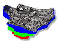
The following maps are also available. These are very large files in TIFF format so the best approach is to right-click and save the files to your computer before opening them for viewing.
The following is the MODFLOW model built by the USGS. Copy the zip file to a directory and unzip.